

Contents

Navigating Storm Season: Essential Storm Radar Tools
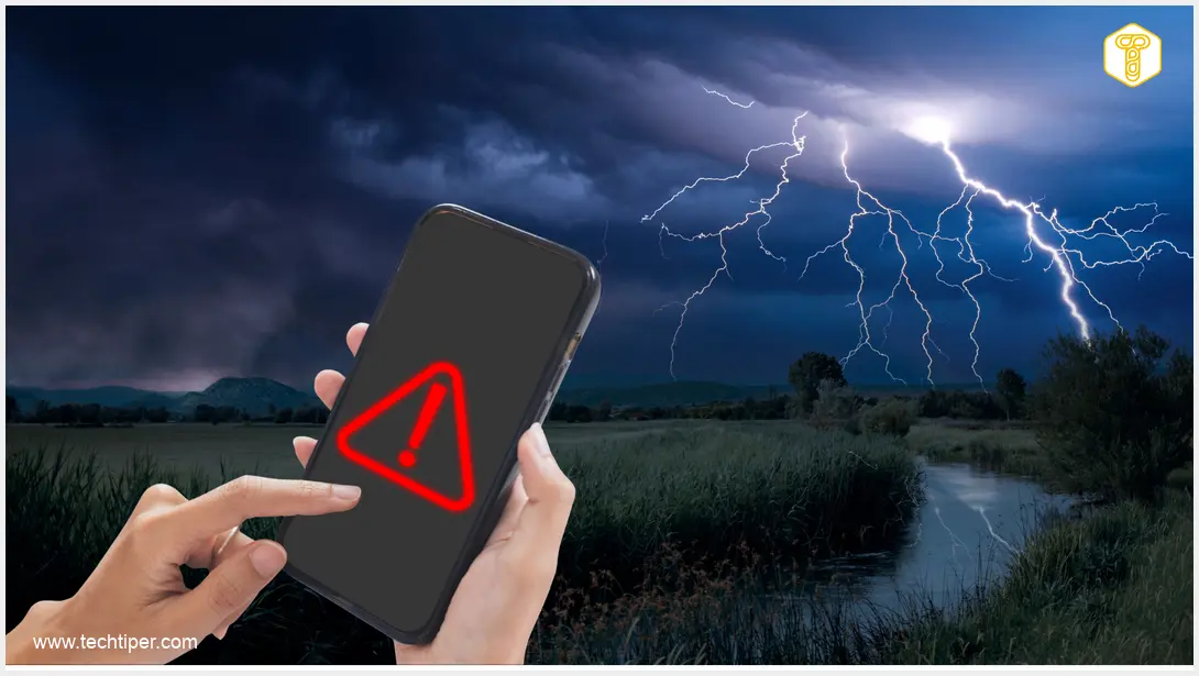
June is often considered one of the most storm-prone months, bringing with it the potential for disruptive weather. Heavy rainfall and thunderstorms can quickly derail outdoor plans and daily routines. This is where the adage “better safe than sorry” truly applies, making it wise to equip yourself with reliable storm radar tools.

Modern storm radars provide invaluable, real-time insights into atmospheric phenomena, helping you stay informed and prepared. Below, we explore some of the most effective and interesting tools available for tracking storms and anticipating adverse weather conditions.
Top Storm Radar Tools for Real-Time Weather Tracking
1. Burze.dzis.net
Our list begins with Burze.dzis.net (conceptually translated as Storms.today.net), a storm radar that, despite its straightforward design, offers features comparable to many contemporary weather services. Its simplicity belies a robust functionality designed to keep you informed.
- Real-time Maps: It provides a constantly updated weather map not only for a broad region but also covers dozens of other European countries, offering a wide scope of observation.
- Historical Data: Beyond current conditions, users can access archived data concerning lightning strikes, providing valuable context for weather patterns.
- Educational Resources: The platform includes a comprehensive Q&A section, addressing critical questions about storm behavior and safety protocols during severe weather events.
- Personalized Alerts: One of its most compelling features is the ability to send customizable alerts regarding potential storms in a specific area. These warnings are reminiscent of national emergency alert systems, ensuring you receive timely notifications.
- Customizable Notifications: You can opt to receive signals about rain, tornadoes, extremely low or high temperatures, and wind directly to your email address, tailoring the alerts to your specific needs.
2. Sieć Obserwatorów Burz (Storm Observers Network)
Next on our list is the Sieć Obserwatorów Burz, a community-driven service that features a dynamic map displaying all violent atmospheric phenomena in real-time. This network leverages the power of collective observation to provide highly localized and current weather intelligence.
- Community-Powered Data: Data is collected directly from over 170 dedicated informants spread across a wide geographical area. This information is then continuously updated on the service by a duty officer, ensuring accuracy and immediacy.
- Beyond Tracking: In addition to dynamic maps and warnings disseminated via social media, the Sieć Obserwatorów Burz actively conducts field operations. These operations are crucial for analyzing damage caused by natural events, offering a deeper understanding of storm impacts.
- Educational Outreach: The network also produces educational materials, aiming to inform the public about severe weather and preparedness. This holistic approach makes it a valuable resource for both real-time alerts and long-term knowledge building.
Understanding how such networks gather and process real-time information can be compared to how digital assistants learn and recall information, much like the Google Gemini memory import feature, where continuous data input refines system awareness.
3. Antistorm.eu
Our final recommendation is Antistorm.eu, a storm radar that operates on a slightly different principle from the previous two. Instead of direct observations, Antistorm.eu sources its maps from external radars, which are then processed and refined by advanced algorithms.
- Algorithmic Forecasting: After a thorough analysis of precipitation movement, the system generates a “velocity field.” This allows for the prediction of rain or thunderstorms with an impressive two-hour lead time, offering users a crucial window for preparation.
- Diverse Alert Options: Similar to Burze.dzis.net, Antistorm.eu also provides alerts about approaching precipitation to interested users. These notifications can be received via SMS, email, or through a dedicated mobile application, catering to various communication preferences.
The sophisticated algorithmic processing used by Antistorm.eu to generate forecasts highlights the increasing integration of advanced technology in our daily lives, much like how integrating AI with car systems like Apple CarPlay or Android Auto enhances navigation and driver assistance.
Frequently Asked Questions (FAQ)
How accurate are storm radars?
Storm radars provide highly accurate, real-time data on precipitation, storm intensity, and movement. However, local microclimates and rapidly developing severe weather can sometimes lead to slight discrepancies. Combining radar data with local observations and official weather warnings offers the most comprehensive picture.
Can storm radars predict tornadoes?
While storm radars cannot directly “predict” a tornado, they are crucial in identifying conditions conducive to tornado formation, such as mesocyclones (rotating updrafts within thunderstorms). Specialized radar products like Doppler radar can detect rotation within storms, leading to tornado warnings issued by meteorological agencies. Always heed official warnings.
What should I do if I receive a storm alert?
Upon receiving a storm alert, immediately seek shelter indoors, away from windows. If you are outdoors, move to a sturdy building or a safe, low-lying area away from trees and utility poles. Disconnect electronic devices to protect against power surges. Follow instructions from local emergency services and stay informed through reliable weather sources.
Are there free mobile applications for storm tracking?
Yes, many excellent free mobile applications offer storm tracking features. Popular options include the apps from national weather services, as well as third-party apps that aggregate radar data. These often provide real-time radar maps, push notifications for alerts, and localized forecasts, making them convenient tools for staying safe.
Frequently Asked Questions (FAQ)
Storm radars provide highly accurate, real-time data on precipitation, storm intensity, and movement. However, local microclimates and rapidly developing severe weather can sometimes lead to slight discrepancies. Combining radar data with local observations and official weather warnings offers the most comprehensive picture.
While storm radars cannot directly “predict” a tornado, they are crucial in identifying conditions conducive to tornado formation, such as mesocyclones (rotating updrafts within thunderstorms). Specialized radar products like Doppler radar can detect rotation within storms, leading to tornado warnings issued by meteorological agencies. Always heed official warnings.
Upon receiving a storm alert, immediately seek shelter indoors, away from windows. If you are outdoors, move to a sturdy building or a safe, low-lying area away from trees and utility poles. Disconnect electronic devices to protect against power surges. Follow instructions from local emergency services and stay informed through reliable weather sources.
Yes, many excellent free mobile applications offer storm tracking features. Popular options include the apps from national weather services, as well as third-party apps that aggregate radar data. These often provide real-time radar maps, push notifications for alerts, and localized forecasts, making them convenient tools for staying safe.
Source: Own elaboration. Opening photo: Freepik / eakkachaihalang / Magnific / Own montage.