

Google Maps is an indispensable application that most of us rely on daily. We use it to find directions, navigate to restaurants, or plan road trips. However, many users only scratch the surface of its capabilities. Tucked away in its settings and features are dozens of options that can significantly streamline your daily commute and urban exploration.

Unlock a Smarter Navigation Experience with Google Maps
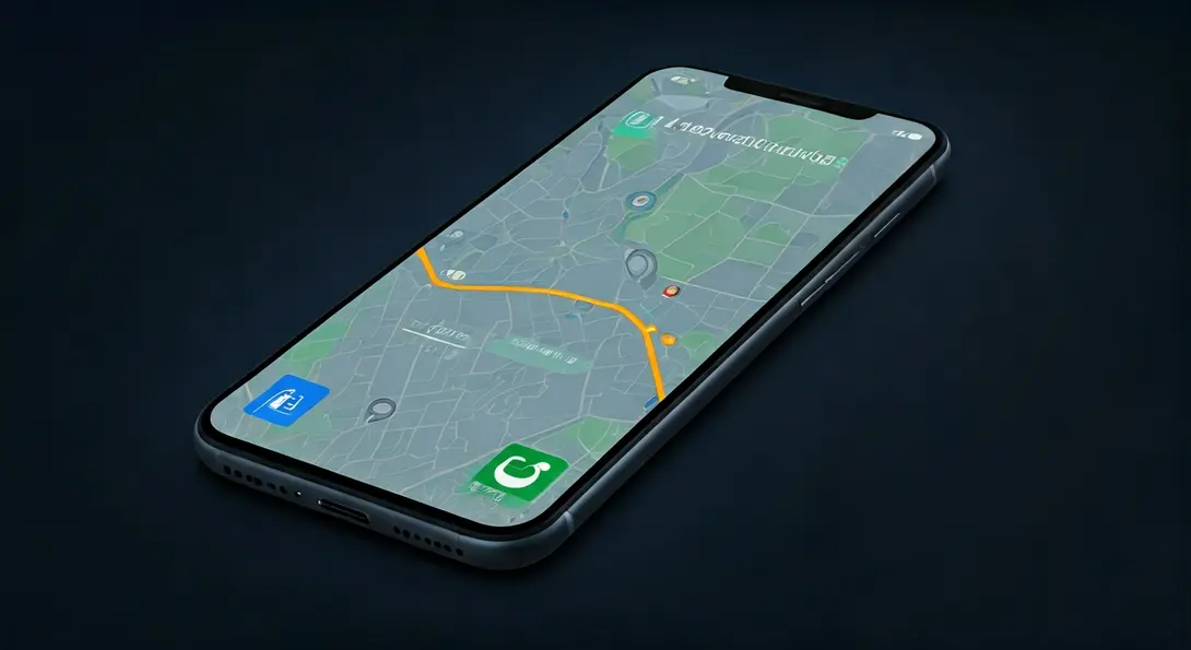
Beyond simply getting from point A to point B, Google Maps offers a suite of advanced functionalities designed to enhance your travel, save you time and money, and provide a more personalized experience. Let’s delve into some of these powerful features you might not be utilizing yet.

1. Fuel-Efficient Routes
You can enable a preference for routes that prioritize fuel efficiency. Google Maps considers factors such as traffic conditions, terrain (hills vs. flat roads), and your vehicle type to suggest a path that consumes less fuel or energy. This small adjustment can lead to notable savings over time and reduce your carbon footprint.
To activate this feature, navigate to the “Navigation” section within Google Maps Settings and select the option to “Prefer fuel-efficient routes.”
2. Specify Your Vehicle Type
Google Maps allows you to inform the app about the type of vehicle you drive – whether it’s a gasoline, diesel, hybrid, or electric car. This information helps Google Maps provide more accurate route suggestions and estimated travel times tailored to your specific vehicle’s characteristics.
3. Add Electric Vehicle Model and Connector Type
For electric vehicle (EV) owners, Google Maps goes a step further. You can specify your exact EV model and the type of charging connector it uses. With this information, the app will intelligently display compatible charging stations along your route or near your destination, making EV travel much more convenient. For more details on how Google Maps is improving EV routing, check out our article on Android Auto EV Route Planning in Google Maps.
4. Live View: Augmented Reality Navigation
When you’re walking, the Live View feature can be a game-changer. Using your phone’s camera, the app overlays arrows and directions directly onto your real-world surroundings. This augmented reality (AR) navigation provides an incredibly intuitive way to find your way, especially in busy or complex pedestrian areas.
5. Manually Save Your Parking Spot
Ever forgotten where you parked? Google Maps has a simple solution. After parking your car, you can manually save its location. Just tap the blue dot representing your current position on the map and select the option to save your parking spot. Later, the app will guide you right back to your vehicle, eliminating the stress of searching.
6. Create Lists and Collections of Places
Organize your world with custom lists. You can create personalized collections of places, such as your favorite restaurants, hotels, tourist attractions, or locations you want to visit on an upcoming trip. These lists can also be easily shared with friends and family, making group planning a breeze.
7. Add Home and Work Addresses
By saving your home and work addresses, you can launch navigation faster and receive more relevant commuting information. The app will also better tailor traffic updates and estimated travel times, providing a more personalized and efficient daily experience.
8. Customize Map Layers
Google Maps offers various map layers to enhance your view. You can switch to satellite view, terrain view, or explore Street View. Furthermore, you can overlay information about air quality, wildfires, and real-time traffic congestion. This allows you to customize how you perceive the map based on your needs.
Simply go to Settings and select the appropriate options in the “Map display” section to toggle these layers on or off.
9. Share Your Live Location
Stay connected and safe by sharing your real-time location with family or friends. Those you share it with can see your current position, your movement, and even your phone’s battery level. This feature is particularly useful for meeting up, ensuring safety, or letting loved ones know your progress during a journey.
10. Lens with Gemini: AI-Powered Exploration
Google Maps is increasingly integrating with Gemini, Google’s advanced AI. With the “Lens with Gemini” feature, you can point your phone’s camera at a building, street, or landmark and ask a question about what you see. The application will analyze the image and display relevant information about your surroundings, acting as your personal AI guide. This integration signifies a new era of interactive navigation and exploration. To learn more about Google’s AI advancements in mapping, read our article on New Google Maps AI Immersive View Update.
These are just a handful of the many powerful features hidden within Google Maps. The application continues to evolve, regularly introducing new tools that many users may not even be aware of. By exploring these options, you can transform your navigation experience and make Google Maps an even more indispensable tool in your daily life.
Frequently Asked Questions (FAQ)
Google Maps calculates fuel-efficient routes by considering various factors, including real-time traffic conditions, the topography of the route (e.g., elevation changes that consume more fuel), and the specific type of vehicle you’ve selected (gasoline, diesel, hybrid, or electric). It aims to find the path that minimizes fuel consumption, often by avoiding heavy acceleration, steep inclines, and frequent stops.
Yes, sharing your live location through Google Maps is designed to be safe and secure. You have full control over who sees your location and for how long. You can choose specific contacts, set a time limit for sharing (e.g., one hour, until you arrive, or indefinitely until you turn it off), and stop sharing at any point. Google Maps uses encryption to protect your location data.
Live View primarily relies on your phone’s camera and GPS for augmented reality navigation, but it also uses Google’s vast street-level imagery data. While it can work in areas with moderate connectivity, a stable data connection (Wi-Fi or mobile data) is generally recommended for the best and most accurate experience, especially for downloading necessary visual data and ensuring real-time positioning.
By adding your electric vehicle (EV) model and connector type, Google Maps can provide highly personalized and practical information. It will prioritize showing you charging stations that are compatible with your specific car and plug type, eliminating guesswork and ensuring you find suitable charging options more easily, particularly useful on long journeys or in unfamiliar areas.
Source: Original content analysis. Opening photo: Gemini